11.3 新西兰(2天)
章节大纲
-
Chapter Challenges
::章次 挑战-
Outline New Zealand’s main physical features explain how the North Island is different from the South Island.
::新西兰的主要自然特征说明了北岛与南岛有何不同。 -
Describe how tectonic plate activity has helped to isolate New Zealand from the rest of the world and still affects the island today.
::描述构造板块活动如何帮助新西兰与世界其他地方隔绝,至今仍影响着该岛。 -
Summarize the situation of the Maori in New Zealand and their relationship with the dominant culture in New Zealand.
::概述新西兰毛利人的状况及其与新西兰主流文化的关系。 -
Describe the economic geography of New Zealand and how the country gains wealth.
::描述新西兰的经济地理以及该国如何获得财富。
Student Learning Objectives
::学生学习目标TEKS Regional Unit 11 Oceania: Chapter 11.3 New Zealand
::TERS 11区域股: 大洋洲: 第11.3章WG.1A Analyze the effects of physical and human geographic patterns and processes on the past and describe their impact on the present, including significant physical features and environmental conditions that influenced migration patterns and shaped the distribution of culture groups today.
::WG.1A 分析物理和人类地理模式和过程对过去的影响,并描述其对目前的影响,包括影响移徙模式并影响当今文化群体分布的重要物理特征和环境条件。WG.2A Describe the human and physical characteristics of the same regions at different periods of time to evaluate relationships between past events and current conditions.
::WG.2A 描述不同时期同一区域的人的和自然的特征,以评估过去事件与当前状况之间的关系。WG.3A Explain weather conditions and climate in relation to annual changes in Earth-Sun relationships.
::WG.3A 结合地球-太阳关系的年度变化解释天气条件和气候。WG.3B Describe the physical processes that affect the environments of regions, including weather, tectonic forces.
::WG.3B 描述影响区域环境的物理过程,包括天气、构造力。WG.4A Explain how elevation, latitude, wind systems, ocean currents, position on a continent, and mountain barriers influence temperature, precipitation, and distribution of climate regions.
::WG.4A 解释高海拔、纬度、风力系统、洋流、大陆位置、山地屏障如何影响气候区域的温度、降水量和分布。WG.4B Describe different landforms and the physical processes that cause their development.
::WG.4B 描述不同的土地形态和导致其发展的物理过程。WG.4C Explain the influence of climate on the distribution of biomes in different regions.
::WG.4C 解释气候对不同区域生物群落分布的影响。WG.5A Analyze how the character of a place is related to its political, economic, social, and cultural elements.
::WG.5A 分析一个地方的特性如何与其政治、经济、社会和文化因素相关。WG.6A Locate and describe human and physical features that influence the size and distribution of settlements.
::WG.6A 确定并描述影响定居点规模和分布的人文和物理特征。WG.6B Explain the processes that have caused changes in settlement patterns, including urbanization, transportation, access to and availability of resources, and economic activities.
::WG.6B 解释导致住区模式变化的进程,包括城市化、运输、获得和获得资源以及经济活动。WG.8A Compare ways that humans depend on, adapt to, and modify the physical environment, including the influences of culture and technology.
::WG.8A 比较人类依赖、适应和改变自然环境的方式,包括文化和技术的影响。WG.8B Describe the interaction between humans and the physical environment and analyze the consequences of extreme weather and other natural disasters such as El Nino, floods. tsunamis, and volcanoes.
::WG.8B 描述人类与自然环境之间的相互作用,分析极端天气和厄尔尼诺、洪水、海啸和火山等其他自然灾害的后果。WG.8C Evaluate the economic and political relationships between settlements and the environments, including sustainable development and renewable/non-renewable resources.
::WG.8C 评价住区与环境之间的经济和政治关系,包括可持续发展和可再生/不可再生资源。WG.9A Identify physical and/or human factors such as climate, vegetation, language, trade networks, political units, river systems, and religion that constitute a region.
::WG.9A 查明构成区域的自然和/或人类因素,如气候、植被、语言、贸易网络、政治单位、河流系统和宗教。WG.10C Compare the ways people satisfy their basic needs through the production of goods and services such as subsistence agriculture versus commercial agriculture or cottage industries versus commercial industries.
::WG.10C 比较人们通过生产商品和服务满足其基本需要的方式,如自给农业,而不是商业农业或家庭手工业,而不是商业工业。WG.10D Compare global trade patterns over time and examine the implications of globalization, including outsourcing and free trade zones.
::WG.10D 比较一段时间的全球贸易格局,审查全球化的影响,包括外包和自由贸易区。WG.11B Identify factors affecting the location of different types of economic activities, including subsistence and commercial agriculture manufacturing, and service industries.
::WG.11B 查明影响不同类型经济活动地点的因素,包括维持生计和商业农业制造业以及服务业。WG.11C Assess how changes in climate, resources, and infrastructure (technology, transportation, and communication) affect the location and patterns of economic activities.
::WG.11C 评估气候、资源和基础设施(技术、运输和通信)的变化如何影响经济活动的地点和模式。WG.18A Analyze cultural changes in specific regions caused by migration, war, trade, innovations, and diffusion.
::WG.18A 分析移徙、战争、贸易、创新和传播在特定区域造成的文化变化。WG.18C Identify examples of cultures that maintain traditional ways, including traditional economies.
::WG.18C 查明保持传统方式的文化实例,包括传统经济。WG.18D Evaluate the spread of cultural traits to find examples of cultural convergence and divergence such as the spread of democratic ideas, US-based fast-food franchises, the English langue, technology, or global sports.
::WG.18D 评价文化特征的传播情况,以寻找文化趋同和差异的例子,例如民主思想的传播、以美国为基地的快餐专营、英语朗格、技术或全球体育。WG.21A Analyze and evaluate the validity and utility of multiple sources of geographic information such as primary and secondary sources, aerial photographs, and maps.
::WG.21A 分析和评价多种地理资料来源,例如主要和次要资料来源、航空照片和地图的有效性和效用。WG.21C Create and interpret different types of maps to answer geographic questions, infer relationships, and analyze change.
::WG.21C 创建和解释不同类型的地图,以回答地理问题、推断关系和分析变化。WG.22A Design and draw appropriate graphics such as maps, diagrams tables, and graphs to communicate geographic features, distributions, and relationships.
::WG.22A 设计和绘制适当的图形,如地图、图表表和图表,以交流地理特征、分布和关系。WG.22B Generate summaries, generalizations, and thesis statements supported by evidence.
::WG.22B 编写摘要、概述和有证据佐证的论文陈述。WG.22E Create original work using proper citations and understanding and avoiding plagiarism.
::WG.22E 利用适当的引证和理解并避免损害,创建原创工作。New Zealand
::新西兰 新西兰 新西兰 新西兰
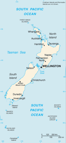
New Zealand Map
::新西兰地图Physical Geography
::物理地理To the east of Australia across the Tasman Sea is the country of New Zealand. New Zealand is one of a number of sets of islands that make up Oceania, also referred to as the Pacific Islands, a region occupying the western and central Pacific Ocean. The Pacific Islands region is generally divided into three sub-regions: Micronesia, Melanesia, and Polynesia, with New Zealand being part of Polynesia.
::在澳大利亚东部横跨塔斯曼海的横跨澳大利亚是新西兰,新西兰是构成大洋洲(又称太平洋群岛)的几组岛屿之一,该群岛占西太平洋和中太平洋,太平洋岛屿区域一般分为三个分区域:密克罗尼西亚、美拉尼西亚和波利尼西亚,新西兰是波利尼西亚的一部分。The Pacific Island region includes more than 25,000 individual small islands representing 25 nations and territories. Most of these islands are very small. The South and North islands of New Zealand are the second- and third-largest islands, respectively. The North and South Islands of New Zealand are separated by a body of water known as the Cook Strait, which is only about 13 miles wide at its narrowest point. The North and South Islands together are about the same size as the US state of Colorado. New Zealand also includes a number of smaller nearby islands.
::太平洋岛屿区域包括25个国家和地区的25 000多个小岛屿,其中多数为非常小的岛屿,新西兰的南岛和北岛分别是第二大和第三大岛屿,新西兰的北岛和南岛被被称为库克海峡的水体隔开,该海峡在最窄处只有13英里宽,北岛和南岛的面积与美国的科罗拉多州大致相同。新西兰还包括一些邻近较小的岛屿。New Zealand, like Australia, is in the Southern Hemisphere, which means that its seasons are expressed at the opposite times of the seasons in North America. In other words, the warmest summer months are January and February and the cooler winter months are June and July. New Zealand lies within the Temperate Zone. There are only very moderate seasonal differences, which are slightly more pronounced in the inland areas because the inland areas lack the moderating influence of the ocean.
::新西兰同澳大利亚一样,在南半球,这意味着其季节表现在北美季节的相反时间,换句话说,最温暖的夏季月份是1月和2月,较寒冷的冬季月份是6月和7月,新西兰在温带区,只有非常中度的季节差异,在内陆地区,由于内陆地区缺乏海洋的调节影响,这些季节差异比较明显。In general, the North Island has somewhat warmer average temperatures than the South Island. In summer, average low temperatures are about 50 °F, with daytime highs around 75 °F. In the winter months, low temperatures average about 35 °F and high temperatures are about 50 °F. The occurrence of more extreme temperatures is limited to the mountainous peaks of the Southern Alps. Snow is common in these mountainous regions but rarely occurs in coastal regions.
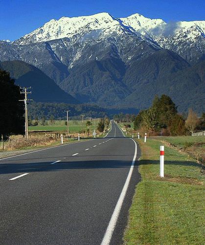
::一般而言,北岛的平均气温比南岛温度要暖一些,夏季平均低温约50摄氏度,日高约75摄氏度。 冬季,低温平均约35摄氏度,高温约50摄氏度。 更极端的气温的发生仅限于南阿尔卑斯山峰。 这些山区普遍发生雪雪,但沿海地区很少发生雪。The Southern Alps is a mountain range extending along much of the length of New Zealand's South Island, reaching its greatest elevations near the range's western side.
::南阿尔卑斯山是沿着新西兰南岛大部分长处延伸的山脉,在南阿尔卑斯山脉西部附近达到最大的海拔。
Rainfall is heaviest on the western coasts of both islands, but especially on the South Island. The prevailing westerly winds, carrying moisture from the ocean, come in contact with the mountains of the Southern Alps and high precipitation results. The mountains also have the opposite effect. On the eastern side of the mountains is a rain shadow where the westerly winds blow hot, dry air and the eastern coasts are therefore substantially drier than the western coasts. Therefore, the average precipitation rates vary widely across the country.
::两个岛屿的西海岸降水量最大,但特别是南岛。 携带海洋水分的流行西风与南阿尔卑斯山的山脉接壤,降水量也很高。 山岳也有相反的效果。 在山东面,雨影使西风吹热、干燥空气和东海岸比西海岸大为干燥。 因此,全国平均降水率差异很大。The average annual rainfall in Christchurch, which is on the eastern coast of the South Island, is about 25 inches per year. Auckland, in the mid-portion of the North Island, receives twice that amount and areas on the wetter western coast receive as much as 115 inches per year.
::位于南岛东海岸的克赖斯特彻奇岛年平均降雨量约为每年25英寸。 奥克兰岛位于北岛中叶,年平均降雨量为两倍,西海岸潮湿地区每年降雨量高达115英寸。As an island nation, New Zealand’s coastlines and oceans are some of its most important geographic features. New Zealand has one of the world’s largest exclusive economic zones, an oceanic zone over which a nation has exclusive rights of exploration and exploitation of marine resources. New Zealand’s exclusive economic zone covers more than one million square miles. The dramatic nature of New Zealand’s landscape is well known to many moviegoers as the landscape of Middle Earth, as depicted in New Zealand film director Peter Jackson’s version of J. R. R. Tolkein’s Lord of the Rings .
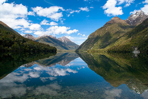
::作为一个岛国,新西兰的海岸线和海洋是其最重要的地理特征之一。 新西兰拥有世界上最大的专属经济区之一,这是一个海洋区,一个国家拥有勘探和开发海洋资源的专属权利。 新西兰的专属经济区面积超过100万平方英里。 许多电影家都知道新西兰地貌的戏剧性是中地球的景观,正如新西兰电影导演彼得·杰克逊(Peter Jackson)的J. R. R. Tolkein的《环环王》所描述的那样。Lake Gunn is a small lake between Lake Te Anau and Milford Sound. It lies close to the New Zealand State Highway 94 and the Divide of the Southern Alps.
::贡恩湖是Te Anau湖和Milford Sound之间的一个小湖,靠近新西兰国家公路94号公路和南阿尔卑斯山分界线。Tectonic Plates and Gondwanaland
::构造平台和贡德瓦纳兰The North Island of New Zealand features a rugged coastline with numerous harbors, bays, and inlets. The port cities of Auckland and Wellington are located on two of the largest bays. The coastline of the South Island is somewhat more regular, except along the southern portion of the eastern coastline, which has deep fjords. Though the North Island has lower relief than its southern counterpart, its few mountains are volcanic in origin.
::新西兰北岛海岸线崎岖不平,港口、海湾和小湾很多,奥克兰和惠灵顿这两个港口城市位于两个最大的海湾,南岛的海岸线较为正常,但东部海岸线南部的海岸线除外,南部的海岸线有深峡湾,虽然北岛的松懈程度低于南部,但很少有山是火山的起源。The two main islands are accompanied by smaller islands around their shores. The North Island’s highest peak is Mount Ruapehu, which reaches almost 9,175 feet, and is an active cone volcano. It is located in the south central part of the island. A range of highlands runs along its eastern side. The volcanism associated with Mount Ruapehu results from New Zealand’s location atop two tectonic plates: the Pacific Plate and the Indo-Australian Plate.
::北岛的最高山峰是鲁阿佩胡山,达到近9 175英尺,是一座活跃的锥形火山,位于该岛中南部,东面有一系列高原。 与鲁阿佩胡山有关的火山活动来自新西兰位于两块构造板块的两块地块:太平洋板块和印澳大利亚板块。The boundary of these two plates forms a subduction zone under the North Island. Consequently, New Zealand experiences tens of thousands of earthquakes per year. Though most of the earthquakes do not greatly disrupt human activity, some have registered higher than 7 on the Richter scale. New Zealanders have made use of the geothermal power generated by this and the tectonic features of this area and hence, New Zealand is home to several hydrothermal power plants.
::这两个板块的边界构成北岛的下潜带,因此,新西兰每年发生数以万计的地震,虽然大多数地震没有严重干扰人类活动,但有些地震在里氏级上已超过7个,新西兰人利用了这个区域产生的地热电源以及这个区域的构造特征,因此,新西兰有几座热液发电厂。A range of mountains, the Southern Alps, divides the South Island lengthwise. Many of the peaks reach over 10,000 feet. The highest peak is Mount Cook, which reaches higher than 12,000 feet. These mountains are also formed by the area’s tectonic situation. However, the two plates meet in a different way under the South Island. Rather than creating a subduction zone, the plates move laterally.
::南阿尔卑斯山是一系列山脉,南阿尔卑斯山,南阿尔卑斯山将南岛长期分割开来,许多峰峰值超过1万英尺,最高的峰值是库克山,峰值超过12,000英尺。这些山峰也是由该地区的构造状况形成的。 然而,南岛下的两个板块以不同的方式交汇。 板块不是建立潜入区,而是横向移动。The lateral movement created the South Alps. New Zealand’s location places it along one of the edges of the Ring of Fire , which encircles the Pacific Ocean basin. The positions and activity of the tectonic plates in this zone cause most of the world’s earthquakes and have formed more than 75 percent of the world’s volcanoes.
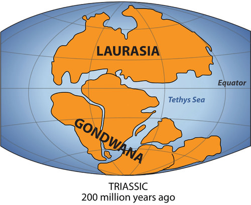
::平流运动创造了南阿尔卑斯山。 新西兰的地理位置使它位于环绕太平洋盆地的火环边缘。 这一区域的构造板块的位置和活动引发了世界大部分地震,并形成了世界火山的75%以上。The southern portion was called Gondwana (Gondwanaland). New Zealand and Australia come from Gondwana; their origin explains why their fauna and flora are so unique.
::南部被称为Gondwana(Gondwanaland),新西兰和澳大利亚来自Gondwana;它们的起源解释了它们的动植物为何如此独特。
New Zealand has a fascinating ecological history. New Zealand was once part of Gondwana, also known as Gondwanaland. About 200 to 500 million years ago, Gondwana was the southern portion of the supercontinent of Pangaea. Gondwana included most of the land in what is the Southern Hemisphere today, including Australia and New Zealand. Over time, through various forms of tectonic activity, the earth’s plates shifted and the supercontinent of Gondwana broke apart, leaving New Zealand geographically isolated for millennia. The species of flora and fauna found in New Zealand either descended from the species found on Gondwana, flew there, floated there via the ocean, or were brought by people.
::新西兰有着迷人的生态史。 新西兰曾经是贡德瓦纳(Gondwana)的一部分,也被称为贡德瓦纳(Gondwana) 。 大约2亿到5亿年前,贡德瓦纳(Gondwana)是潘加埃亚超级大陆的南部。冈德瓦纳(Gondwana)将大部分土地包含在今天的南半球,包括澳大利亚和新西兰。 随着时间的推移,通过各种形式的构造活动,地球板块被改变,贡德瓦纳的超级大陆破裂,使新西兰在地理上被隔绝了几千年。 新西兰发现的动植物物种不是来自贡德瓦纳(Gondwana)发现的物种,就是从那里飞到那里,漂浮在海洋中,就是由人类带来的。Biodiversity in New Zealand
::新西兰生物多样性New Zealand’s geological history has laid the groundwork for more than 2,000 indigenous plant species, about 1,500 of which are found nowhere else in the world. The biomes of the North Island include a subtropical area, including mangrove swamps, an evergreen forest with dense undergrowth of mosses and ferns, and a small grasslands area in the central volcanic plain. The South Island biomes include extensive grasslands in the east, which are excellent for agricultural pursuits; forest areas, dominated by native beech trees in the west; and an alpine vegetation zone in the Southern Alps.
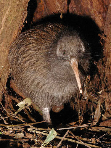
::新西兰的地质历史为2 000多个土著植物物种奠定了基础,其中约1 500个物种在世界上找不到,北岛的生物群落包括一个亚热带地区,包括红树林沼泽、一个生长密集的苔稼和幼苗生长不足的常青林和中火山平原的一个小草原地区。 南岛的生物群落包括东部大片草原,这些草原对农业追求非常有利;森林区以西部的原生青蜂树为主;南阿尔卑斯山的一个高山植被区。In terms of fauna, the most influential factor may be the relative absence of predatory mammals, again related to New Zealand’s geological history. With few ground predators and a favorable climate, bats, small reptiles, and birds were able to thrive and flourish. Without predators, many species of birds became flightless, such as the noted Kiwi. New Zealand’s most famous bird, the moa, was similar to the ostrich but is now extinct. Moa could grow to more than 12 feet high and weigh more than 500 pounds. New Zealand is known for its large number of species of wild birds. The Kiwi is the most noted and is often used to refer to people from New Zealand, as it is the national symbol of the country.
::就动物群而言,最有影响力的因素可能是相对缺乏食肉性哺乳动物,这又与新西兰的地质历史有关。 几乎没有地面捕食动物和有利的气候、蝙蝠、小爬虫类和鸟类能够发芽和发芽。 没有食肉动物,许多鸟类物种就变得无机,如有名的基维人。 新西兰最著名的鸟类,即呻吟鸟,与食鸟相似,但现在已经灭绝了。 Moa可能长到12英尺以上,体重超过500磅。 新西兰以大量野生鸟类为名。 基维人是最有名的,也常常被用来指新西兰人,因为它是新西兰的国家象征。Kiwis are flightless birds native to New Zealand.
::Kiwis是新西兰本地的无飞行鸟类。
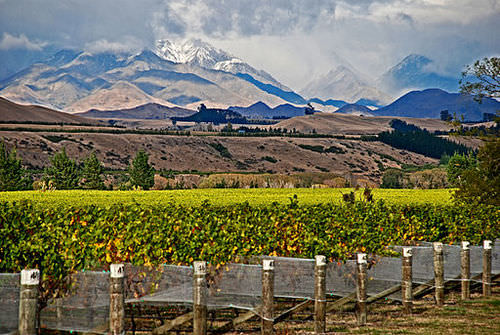
New Zealand has a variety of landscapes that have been attractive for economic activity and tourism. The South Island is larger than the North Island and is more mountainous. The snowcapped peaks of the Southern Alps run the western length of the South Island. Large livestock-raising operations and agricultural activities can be found on the vast grasslands of the South Island. Millions of sheep and cattle are raised on the grassy highlands and the valley pasturelands. The North Island has more low-lying terrain, which is also good for agriculture and is home to a large dairy industry. The central highlands of the north offer some rugged relief and provide for a diverse physical landscape.
::新西兰有各种对经济活动和旅游业具有吸引力的景观,南岛比北岛大,多山,南阿尔卑斯山峰的雪峰占南岛的西长,在南岛广大草原上可以发现大规模的畜牧业和农业活动,在草原和河谷牧场上饲养成百万头绵羊和牛,北岛地势较低,也有利于农业,也是大型奶制品工业的家园,北部中部高原提供一些崎岖的救济,提供多种多样的自然景观。Cultural Dynamics and the Maori
::文化动态和毛利人New Zealand is home to many Polynesian groups. Its original inhabitants were the Maori, who came to the islands around the 10th century. They grew crops of gourds and sweet potatoes. Fur seals were hunted regularly, as were moa, which were hunted to extinction before the Europeans arrived. The Maori had created extensive trading networks with other island groups and developed a heritage of traditional rituals and cultural ways. The Maori culture thrived for hundreds of years and was well established in New Zealand before the arrival of the colonial ships from Europe.
::新西兰是许多波利尼西亚族的家园,其原始居民是毛利人,他们大约在10世纪来到群岛,种植古尔德和甜土豆作物,定期捕猎富尔海豹,以及在欧洲人抵达之前被猎杀的呻吟,毛利人与其他岛屿群体建立了广泛的贸易网络,并发展了传统仪式和文化方式的遗产,毛利人文化蓬勃发展了数百年,在欧洲殖民船只抵达之前,在新西兰已经建立了良好的文化。Britain was the main colonizer of the islands. The British settled in to establish their presence and gain control. In 1840, the British colonizers and the Maori signed the Treaty of Waitangi, which granted British sovereignty over the islands but allowed the Maori certain rights over tribal lands. The actual language in this treaty has been debated between the English version and the Maori version.
::1840年,英国殖民者和毛利人签署了《威坦哲条约》,该条约授予英国对群岛的主权,但允许毛利人对部落土地拥有某些权利。Over time the tribal lands were codified into legal arrangements by the European colonizers. Since the Treaty of Waitangi, the situation has evolved, with subsequent land exchanges, some legal and others questionable. The Maori have complained about unfair treatment and the loss of land and rights in the process. These issues have finally reached a point of negotiation in the past couple of decades. Starting in the 1990s, treaty settlements have been made to help correct the actions of the colonial activity and compensate the Maori for the conditions to which they were subjugated.
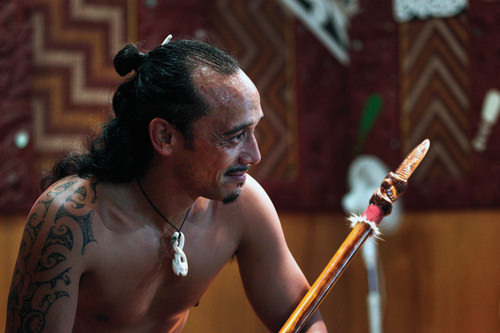
::自《威坦哲条约》签署以来,情况已发生变化,后来的土地交换,有些是合法,另一些则是可疑的;毛利人抱怨在这一进程中受到不公正的待遇,丧失土地和权利;过去几十年,这些问题终于到了谈判的地步;从1990年代开始,通过条约解决,帮助纠正殖民活动的行动,并补偿毛利人被征服的条件。Many Maori participate in performances in New Zealand both for tourism and to maintain their heritage and traditions.
::许多毛利人在新西兰参加旅游和保持其遗产和传统的表演。
Most of the Maori have lived on the North Island. They were a real concern for the European colonizers. Claimed by Great Britain in their colonial empire, the country of New Zealand became independent of Britain in 1901. According to the CIA World Factbook, the estimate of the population in 2017 of the country was at about 4.5 million. According to the New Zealand 2013 census, Europeans are 74 percent of the population and the Maori are 14.09 percent. There are also many people who are of mixed ethnic background, including Maori and other groups. Asians, Polynesians, and other ethnic minorities make up the rest. New Zealand’s main religion is Christianity and English is the official language.
::多数毛利人居住在北岛,是欧洲殖民者真正关心的。1901年,英国在其殖民帝国中声称,新西兰国家独立于英国。根据中央情报局的《世界实况手册》,2017年该国人口估计约为450万。根据新西兰2013年人口普查,欧洲人占人口的74%,毛利人占14.09%。还有许多人具有混杂的族裔背景,包括毛利人和其他群体。亚洲人、波利尼西亚人和其他少数民族组成其余群体。新西兰的主要宗教是基督教,英语是官方语言。The Maori have not been integrated into New Zealand society to the same extent as Europeans have. The Maori now join the ranks of other Pacific Islanders that have moved to New Zealand from Samoa, Tonga, Cook Islands, and many other places in the South Pacific. New Zealand’s urban areas reflect diversity in the various cultural landscapes and ethnic communities that have established themselves in specific neighborhoods within the main cities.A common dilemma with all peoples is the draw to return to their heritage and roots, which typically results in a more traditional lifestyle with stronger cultural ways. At the same time, the modern world pulls people toward a more global and cosmopolitan culture that is steeped in modernity with changing fashions. The Maori and other ethnic groups in New Zealand find themselves facing a challenge to balance their traditional lifestyles and the modern world.
::与所有民族共同的两难境地是回归其遗产和根基,这通常导致一种更传统的生活方式,其文化方式更强。 与此同时,现代世界将人们拉向一种更加全球化和世界性的文化,这种文化随着时尚的改变在现代化中蓬勃发展。 新西兰的毛利人和其他族裔群体发现自己面临着平衡其传统生活方式和现代世界的挑战。Economic Conditions
::经济状况Land and climate could be said to be New Zealand’s most important natural resources. Fertile soils and a mild climate, complete with thousands of hours of sunshine annually, create ideal conditions for agriculture. Grass continues to grow throughout the year, which means that sheep and other livestock have plenty to graze upon. Wool and other agricultural products, notably meat and butter, are important exports for New Zealand’s economy. Healthy forests produce timber products, which are important to the economy as well. Some of New Zealand’s natural resources are found underground, including coal, natural gas, gold, and other minerals.
::土地和气候可以说是新西兰最重要的自然资源。 肥沃的土壤和温和的气候,加上每年数千小时的阳光,为农业创造了理想的条件。 草地在全年持续增长,这意味着绵羊和其他牲畜有丰富的食用。 羊毛和其他农产品,特别是肉类和黄油,是新西兰经济的重要出口产品。 健康的森林生产木材产品,对经济也很重要。 新西兰的一些自然资源,包括煤炭、天然气、黄金和其他矿物,在地下被发现。Wellington is the capital of the country and is located on the southern end of the North Island. Wellington is one-fourth the size of the primary city, Auckland, which has 1.45 million people and is located in the north. The major cities are located along the coastal regions and provide a connection to sea transportation. Christchurch is the largest city of the South Island and is located along the eastern seaboard on the productive Canterbury Plain. The soils and conditions on the Canterbury Plain are excellent for productive agriculture of all types. Coastal plains also provide access to building transportation systems of highways and railroads that are more costly to construct in the mountainous regions of the Southern Alps or the northern highlands.
::惠灵顿是该国首府,位于北岛南端;惠灵顿是主要城市奥克兰的四分之一,拥有145万人,位于北部;主要城市位于沿海地区,与海上运输连接;赫里斯特彻奇是南方最大的城市,位于生产性的坎特伯雷平原东海岸;坎特伯里平原的土壤和条件对各类生产性农业都很好;沿海平原还提供建造公路和铁路运输系统的通道,这些公路和铁路在南阿尔卑斯山地区或北部高原建造费用更高。Agricultural products make up a large portion of the nation’s exports that contribute to the country’s economy.
::农产品占国家出口的很大一部分,为国家经济做出贡献。
The modern cities are home to many processing centers that prepare the abundant agricultural products for domestic consumption and for export products. The ever-growing populations of Asia and the rest of the world continue to place a high demand on food products and welcome New Zealand’s agricultural exports. In relation to how countries gain wealth, agricultural profits are competitive and normally provide a low profit margin.
::现代城市是许多加工中心的所在地,这些加工中心为国内消费和出口产品准备了丰富的农产品。 亚洲和世界其他地区不断增长的人口对食品的需求仍然很高,欢迎新西兰的农产品出口。 关于国家如何获得财富,农业利润具有竞争力,通常提供低利润率。New Zealand does not gain a large part of its national income from mining or manufacturing, though these industries do exist. The high standard of living that in New Zealand is similar to that of Australia in that the population is not large. This allows the national wealth to be distributed through the private sector economy to provide a comfortable standard of living.
::新西兰虽然有采矿或制造业,但国民收入的大部分并不来自采矿或制造业,新西兰的高生活水平与澳大利亚相似,因为人口并不多,这使得国家财富通过私营部门经济进行分配,以提供舒适的生活水平。New Zealand has a market economy. The mainstay of the economy is, and has been for many years, a productive agricultural sector that has been geared toward export profits. New Zealand’s climate and soils help give it a place in the economy of the region through agricultural exports. A “wool boom” in the 1950s furthered the emphasis on agricultural products as tremendous profits were made in the wool production and export industry.
::新西兰拥有市场经济,经济的支柱是、而且多年来一直是面向出口利润的生产性农业部门。 新西兰的气候和土壤通过农业出口帮助它在该区域经济中占有一席之地。 1950年代的“暴涨”进一步突出了对农产品的强调,因为羊毛生产和出口行业获得了巨大的利润。Today, New Zealand’s economy is still heavily focused on the export of agricultural products, though the economy has diversified into other areas such as tourism and exploitation of natural resources, especially natural gas. The development of hydroelectricity generation in recent years has been important to the economy.
::今天,新西兰的经济仍然主要集中于农产品出口,尽管经济已经多样化,进入了其他领域,如旅游业和开采自然资源,特别是天然气。 近年来,水力发电的发展对经济非常重要。Key Takeaways
::密钥外出-
New Zealand has been isolated by the separation of continents through tectonic plate action. Shifting plates continue to create earthquakes and volcanic activity in the region.
::新西兰因各大陆通过构造板块行动分离而孤立,移动板块继续在该区域造成地震和火山活动。 -
New Zealand has high mountains, with the Southern Alps along the western coast of the South Island and highlands along the eastern side of the North Island. Adequate rainfall and good soils provide for excellent agricultural production, which has been the traditional economic activity.
::新西兰有高山,南阿尔卑斯山沿南岛西海岸,北岛东岸高地,降雨量充足,土壤肥沃,农业生产优良,这是传统的经济活动。 -
The Maori were established in New Zealand before the British colonized it. Various agreements were made to work out common arrangements, with varying degrees of success. The Maori continue to be a minority population and have not acculturated into the mainstream society of the country.
::毛利人是在英国殖民之前在新西兰建立的,已达成各种协议,以达成共同安排,并取得了不同程度的成功,毛利人仍然是少数人口,尚未进入该国的主流社会。 -
New Zealand has historically relied on agricultural exports for national income. Shifting global markets and changes in government policies and structures have highly affected the economy of New Zealand. The country continues to work its way through the transition to a more global economy.
::新西兰历来依赖农业出口赚取国民收入,全球市场的变化以及政府政策和结构的变化对新西兰经济产生了严重影响,新西兰正在继续努力向更全球化的经济过渡。
Vocabulary Terms
::词汇术语术语Chapter 11.3 New Zealand
::第11.3章 新西兰Maori
::毛利族a Polynesian people who were the first inhabitants of New Zealand
::a 波利尼西亚人民是新西兰第一批居民。pakeha
::a Maori word that means "European white people"
::毛利语,意思是"欧洲白人"Ring of Fire
::火环A chain of volcanoes that line the Pacific Ocean
::太平洋的一连串火山Applying Knowledge
::应用知识Interactive Notebook Activities
::互动笔记活动-
Outline
New Zealand’s main physical features
explain
how the North Island is different from the South Island.
::新西兰的主要自然特征说明了北岛与南岛有何不同。 -
Describe
how tectonic plate activity has helped to isolate New Zealand from the rest of the world and still affects the island today.
::描述构造板块活动如何帮助新西兰与世界其他地方隔绝,至今仍影响着该岛。 -
Summarize
the situation of the Maori in New Zealand and their relationship with the dominant culture in New Zealand.
::概述新西兰毛利人的状况及其与新西兰主流文化的关系。 -
Describe
the economic geography of New Zealand and how the country gains wealth.
::描述新西兰的经济地理以及该国如何获得财富。
Discussion and Study Questions
::讨论和研究问题-
What are the main physical features of the South Island and North Island of New Zealand?
::南岛和新西兰北岛的主要自然特征是什么? -
How is the North Island different from the South Island in population and economic activities?
::在人口和经济活动方面,北岛与南岛有什么不同? -
How has physical geography been helpful in the economic development of New Zealand?
::地理地理对新西兰经济发展有何帮助? -
Where are the main cities of New Zealand? What are the capital and the largest cities on each island?
::新西兰的主要城市在哪里?每个岛屿的首都和最大城市在哪里? -
Who were the inhabitants of New Zealand before the colonial era? Where did they come from?
::在殖民时代之前,谁是新西兰居民?他们来自何方? -
What issues do these inhabitants of New Zealand have with the current government?
::这些新西兰居民对现政府有什么问题? -
How are the dynamics with the Maori similar to those with the Aborigines in Australia?
::毛利人的动态与澳大利亚土著人的动态如何相似? -
What are the main methods that New Zealand has used to gain national wealth?
::新西兰为获得国民财富而采用的主要方法是什么? -
How has the economic situation in New Zealand changed over the past few decades?
::新西兰的经济形势在过去几十年中是如何变化的? -
How is New Zealand different in physical and human geography from Australia?
::新西兰在物理和人文地理上与澳大利亚有何不同?
Real-World Geography Exercise
::现实世界地理演习-
Using
, complete the following activities:
-
Locate each place on the bulleted list below.
::在下面的子弹名单上 找到每个地方 -
Find the nearest city with an international airport in proximity to each location on the bulleted list below.
::找到最近的城市,在下面子弹清单上每个地点附近有一个国际机场。 -
Calculate the distance and travel time by plane to each city from the
in Philadelphia, Pennsylvania.
::计算从宾夕法尼亚州费城到每个城市的 飞机距离和旅行时间
::使用,完成以下活动: 确定以下子弹清单中的每个地点; 找到最近的城市, 在下面子弹清单中的每个地点附近有一个国际机场。 计算从宾夕法尼亚费城飞往每个城市的飞机距离和飞行时间。 -
Locate each place on the bulleted list below.
-
Using
, determine the latitude and longitude for each location on the bulleted list below.
::使用,确定以下子弹列表中每个位置的纬度和经度。 -
Be prepared to share and discuss your answers.
::准备分享和讨论你的答案
-
Auckland
::奧克蘭語Name -
Canterbury Plain
::坎特伯雷平原 -
Cook Strait
::库克群岛海峡 -
Christchurch
::克赖斯特彻奇 -
Mount Cook
::库克山 -
Mount Ruapehu
::鲁阿佩胡山 -
Southern Alps
::南阿尔卑斯山 -
Wellington
::惠灵顿
Current Events
::当前事件Videos for Geography Enrichment
::地理丰富视频Helpful Websites for the Study of Geography
::地理研究有用网站is an encyclopedia funded by the Canadian government covering all branches of knowledge. Their scholarly collection includes interactive materials.
::该百科全书由加拿大政府资助,涵盖所有知识分支,其学术收藏包括交互式材料。provides information on the people, history, government, economy, energy, geography, communications, transportation, military, and transnational issues for the world's entities.
::向世界各实体提供关于人民、历史、政府、经济、能源、地理、通信、运输、军事和跨国问题的资料。is a US government website where you can find federal legislation, past and present, as well as information about the US legal system.
::是一个美国政府的网站,您可以在此找到过去和现在的联邦立法以及关于美国法律制度的信息。is a government agency website that provides current news, resources, topics of interest, information about drugs, careers in the DEA, and a tip hotline.
::是一个政府机构网站,提供最新消息、资源、感兴趣的话题、毒品信息、在缉毒局的职业以及一条小费热线。is the largest library in the world and provides manuscripts, files, information, pictures, and videos.
::图书馆是世界上最大的图书馆,提供手稿、文件、信息、图片和录像。is a US government agency website that allows users to search for and retrieve satellite images of Earth.
::这是一个美国政府机构的网站,用户可以搜索和检索地球的卫星图像。is a US government website that provides historical documents, photos, records, publications, and educator resources.
::这是一个美国政府网站,提供历史文件、照片、记录、出版物和教育资源。is a US government agency website that provides weather-related information and ocean research.
::是一个提供气象信息和海洋研究的美国政府机构网站。is a website by the United States Geological Survey and other federal, state, and local agencies that delivers topographic information for the United States.
::这是美国地质调查局和其他联邦、州和地方机构为美国提供地形信息的网站。is a massive central data source and a handy way to graphically compare nations.
::是一个庞大的中央数据源,是用图形比较国家的一种方便方式。is a website that measures most locations in the world for air pollution in real time.
::是一个实时测量世界上大多数空气污染地点的网站。is a unique statistical database, which allows you to research and compare a multitude of different data on US states.
::这是一个独特的统计数据库, 使你能够研究和比较关于美国各州的多种不同数据。is an international organization founded in 1945 and made up of 193 member states. The UN maintains international peace and security, protects human rights, delivers humanitarian aid, promotes sustainable development, and upholds international law.
::联合国是一个国际组织,成立于1945年,由193个成员国组成。 联合国维护国际和平与安全,保护人权,提供人道主义援助,促进可持续发展,维护国际法。is a US government agency that provides a population clock, data, surveys, statistics, a library with information and infographics, news about the economy, and much more.
::这是一个美国政府机构,它提供人口钟、数据、调查、统计、一个拥有信息和信息资料的图书馆、关于经济的新闻,以及更多。is a US government agency website that provides scientific information about the natural hazards that threaten lives, the natural resources we rely on, the health of our ecosystems and environment, and the impacts of climate and land-use change.
::这是一个美国政府机构的网站,提供科学信息,说明威胁生命的自然危害、我们赖以生存的自然资源、生态系统和环境的健康以及气候和土地使用变化的影响。is a US government website that provides the latest presidential news, information about the budget, policy, defense, and many more topics.
::提供最新总统新闻、预算、政策、国防等资讯, 以及更多议题。is under the United Nations and provides leadership on matters critical to health; shapes the research agenda on health; and monitors the health situation and assessing health trends around the world. Their website provides information on the state of health around the world, outbreaks, current health news, and more.
::他们的网站提供世界各地卫生状况、疫情爆发、最新卫生新闻等信息。is an intergovernmental organization that regulates international trade. The website provides information on the history of the multilateral trading system, featured videos, news and events, trade topics, and more.
::该网站提供关于多边贸易体系历史的信息、视频、新闻和事件、贸易专题等等。 -
Outline New Zealand’s main physical features explain how the North Island is different from the South Island.